
Beddgelert Forest, near Beddgelert
Huge forest in the heart of Eryri (Snowdonia)...

The Cascades Trail and the Quarryman’s Trail are closed due to a landslide.
Coed Nant Gwernol woodland lies on the edge of Abergynolwyn village.
The woodland takes its name from a rocky river gorge with cascading waterfalls.
On the plateau above the river gorge lie the remains of Bryn-Eglwys Slate Quarry which is now part of the Slate Landscape of Northwest Wales World Heritage Site.
Two of our waymarked walking trails follow the river and explore the remains of Bryn-Eglwys Slate Quarry.
The Talyllyn narrow-gauge railway runs through Coed Nant Gwernol and the walking trails can be started from two of the stations along the line – see the walking trails section below.
The walking trails are waymarked from start to finish.
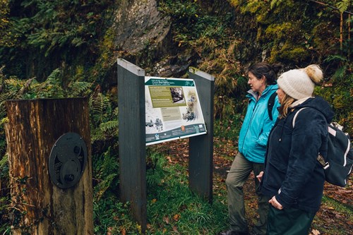
Look out for the information panel at the start of the trail.
Find out about walking trail grades.
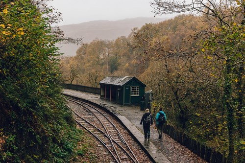
The Stations Link is a linear route between Nant Gwernol station and Abergynolwyn station which are both on the Talyllyn railway.
There are views of the surrounding mountains, steam trains on the Talyllyn railway and the historic Allt Wyllt incline, part of the former quarry.
Starting points for the Stations Link Trail
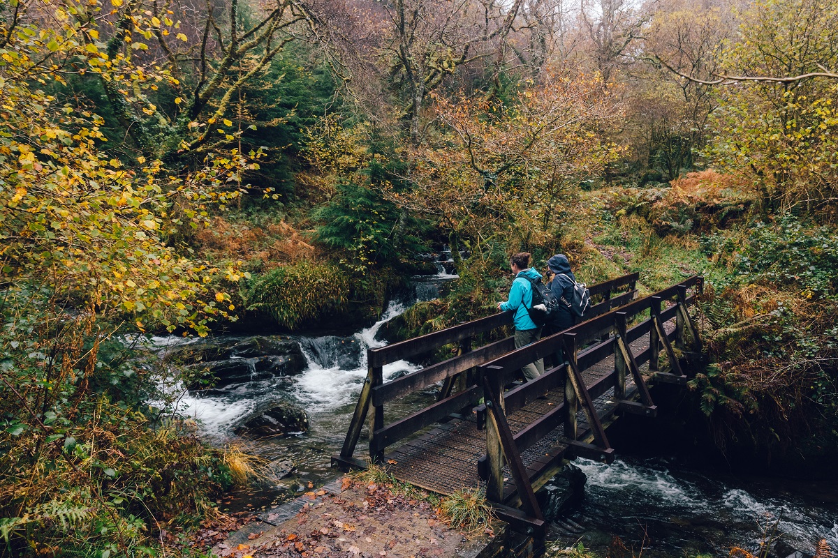
The Cascade Trail climbs uphill, closely following the cascading river.
It then crosses a wooden bridge onto the old tramway and descends steeply alongside part of the old Allt Wyllt incline back to Nant Gwernol station.
Look for the remains of the drumhouses for the winding gear, or winch, at the top.
Starting points for the Cascades Trail
Highlights of this trail include the wide views, waterfalls and quarry remains.
Look out for the panels and wind-up listening posts that tell the story of the Bryn-Eglwys quarrymen and their families.
Starting points for the Quarryman’s Trail
Coed Nant Gwernol is part of Dyfi Forest.
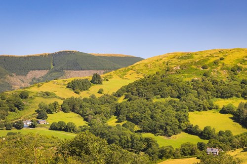
Situated between the towns of Machynlleth and Dolgellau Dyfi Forest lies in the shadow of Cadair Idris.
The woodlands cling to the steep hillsides of the Tarren and Dyfi mountain ranges cut through by the Dysynni, Dulas and Dyfi rivers heading west to the nearby sea.
The whole area was once filled with thriving slate mines, employing hundreds of people.
The finished slate was moved to the coast via a system of tramways and steam trains for export.
The remaining trains now carry holidaymakers through the countryside.
In addition to Coed Nant Gwernol, there are walking trails in these other Natural Resources Wales woodlands within Dyfi Forest:
Most of Dyfi Forest is in Eryri (Snowdonia) National Park.
Snowdonia is the largest National Park in Wales and is home to picturesque towns and villages and the highest mountain in Wales.
It is looked after by the Eryri National Park Authority.
For more information about visiting Eryri go to the Eryri National Park Authority website.
Dyfi Forest forms part of the National Forest for Wales.
The National Forest will:
It will form a connected ecological network running throughout Wales, bringing social, economic and environmental benefits.
Parts of the network will eventually form a trail running the length and breadth of Wales, so anyone can access it wherever they live.
For more information go to the National Forest for Wales website.
The Talyllyn Railway runs through Dyfi Forest on its route between Tywyn on the coast to Nant Gwernol station near the village of Abergynolwyn.
The line was originally opened to carry slate from the quarries at Bryn-Eglwys to Tywyn and it is now a heritage railway.
Our walking trails can be started from two of the stations along the line – see the walking trails section above.
For more information go to the Talyllyn Railway website.
We want you to return home safely after your visit here.
You are responsible for your own safety as well as the safety of any children and animals with you during your visit.
Please note:
For advice and tips to help you plan your visit here go to Visiting our places safely.
See the top of this webpage for details of any planned closures or other changes to visitor facilities here.
For your safety, always follow instructions from staff and signs including those for trail diversions or closures.
We may divert or close trails whilst we undertake maintenance work or other operations and we may need to close other visitor facilities temporarily.
In extreme weather, we may close facilities at short notice due to the risk of injury to visitors and staff.
Coed Nant Gwernol is 12 miles south of Dolgellau.
It is in the county of Gwynedd.
From the A487 northbound, turn left onto the B4405 just after Corris for Abergynolwyn or Tywyn (for the Talyllyn railway).
From the A487 southbound, turn right onto the B4405 just after the Minffordd pub for Abergynolwyn or Tywyn (for the Talyllyn railway).
Coed Nant Gwernol woodland is on Ordnance Survey (OS) Explorer map OL 23.
The OS grid reference is SH 681 067.
The three walks start from Nant Gwernol station but there is no parking at Nant Gwernol station itself.
From Tywyn you can catch a steam train on the Talyllyn Railway to Abergynolwyn village station or Nant Gwernol station.
The nearest train station is in Tywyn For details of public transport visit www.traveline.cymru
There are no staff at this location.
Contact our customer team for general enquiries during office hours, Monday to Friday.


