
Afan Forest Park – Visitor Centre, near Port Talbot
Main starting point for mountain bike and walking...
The following mountain bike trails are diverted:
Glyncorrwg Mountain Bike Centre is in Afan Forest Park.
Some of our mountain bike trails start from the visitor centre car park.
Most of our mountain bike trails start from Afan Forest Park Visitor Centre.
All our mountain bike trails are waymarked from start to finish and have been graded for difficulty.
At the start of the trail there is an information panel – please read this before setting off.
This gentle trail follows the wide, flat route of an old railway track that once carried passengers and coal the length of the valley.
On over 14 kilometres of disused railway and forest roads this trail connects the communities of Pont-rhyd-y-fen and Glyncorrwg - a great way to explore the Afan Valley.
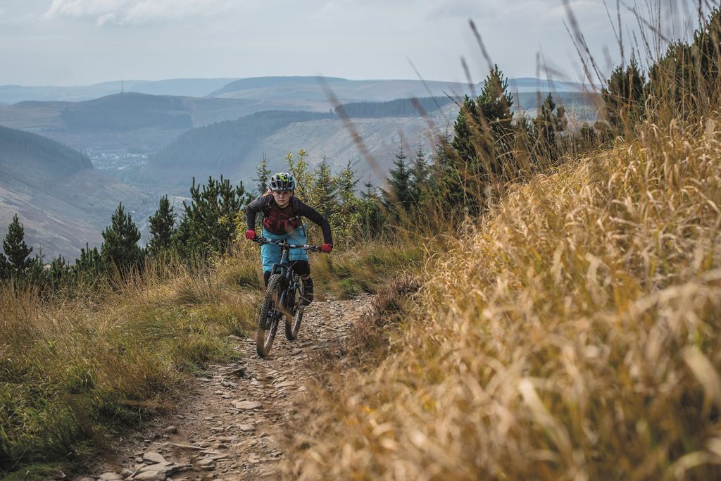
This is the most technical of all the trails in Afan Forest Park and is 90% purpose-built singletrack.
A 6 kilometre sheep-track climb gives fantastic views of the Afan Valley.
Extreme exposure on tight singletrack means ultimate thrills and long, demanding descents with rocky steps to negotiate.
There is a challenging alternative final descent which is black-graded (Tyn y Pan).
Blade has lots of singletrack, offering a great trail for more experienced riders.
This trail takes you to higher and more remote sections of the forest with amazing views over the Bannau Brycheiniog National Park.
It twists and winds through the distant forest with some tough technical climbs and descents before dropping back to Glyncorrwg.
You can also join onto the farthest loop of the Skyline trail but make sure you are properly equipped as this extra loop takes you to a very remote area with changeable weather conditions.
Sharing the same ascent as White’s Level, this trail continues with long, forest road climbs and flowing technical singletrack descents.
You will be treated to stunning skyline views of the Bannau Brycheiniog National Park, the Preselis, the Black Mountains and the South Wales coast.
This route will test your stamina and your nerve, with technical singletrack sections such as ‘On The Edge’ and ‘Excalibur’.
Your reward will be out-stretched views and a rocky, 6 kilometre singletrack descent back into Glyncorrwg.
The car park, visitor centre and other facilities here are not managed by Natural Resources Wales.
For more information, go to the Glyncorrwg Mountain Bike Centre Facebook page.
Glyncorrwg Mountain Bike Centre is situated in Afan Forest Park.
Afan Forest Park is one of Britain’s iconic mountain bike destinations and a popular place for walking.
The forest park is situated in the Afan Valley, a former coal mining valley just a few miles from the M4, and you can discover some of the valley’s heritage features along our trails.
Explore Afan Forest Park from these other car parks:
We want you to return home safely after your visit here.
You are responsible for your own safety as well as the safety of any children and animals with you during your visit.
For advice and tips to help you plan your visit here go to Visiting our places safely.
See the top of this webpage for details of any planned closures or other changes to the trails here.
For your safety, always follow instructions from staff and signs including those for trail diversions or closures.
We may divert or close trails whilst we undertake maintenance work or other operations and we may need to close other visitor facilities temporarily.
In extreme weather, we may close facilities at short notice due to the risk of injury to visitors and staff.
You may need permission from us to organise an event or to carry out some activities on our land.
Check if you are allowed to use our land.
We recommend you follow these directions or use the Google map below which has a pin on this place’s location.
Glyncorrwg Mountain Bike Centre is 10½ miles north east of Port Talbot.
Exit M4 at junction 40 for Port Talbot and follow signs onto A4107 towards Cymer.
Follow the brown and white signs for Afan Forest Park from the roundabout.
Go past the car park for Afan Forest Park Visitor Centre on the right.
Continue for 3 miles and go through Cymer.
Then follow the brown and white signs for Glyncorrwg Mountain Bike Centre.
The Ordnance Survey (OS) grid reference for the car park is SS 872 984 (Explorer Map 166).
The postcode is SA13 3EA. Please note that this postcode covers a wide area and will not take you directly to the entrance.
Sustrans National Cycle Network route 887 goes to Afan Forest Park. For more information go to the Sustrans website.
View this place on the What3Words website.
The nearest mainline railway station is in Maesteg.
For details of public transport go to the Traveline Cymru website.
The car park at Glyncorrwg Mountain Bike Centre is privately managed.
For more information, go to the Glyncorrwg Mountain Bike Centre website.
The car park and other visitor facilities at Glyncorrwg Mountain Bike Centre are privately managed. For more information, go to the Glyncorrwg Mountain Bike Centre website.
There are no Natural Resources Wales staff at this location. Contact our customer team for general enquiries during office hours, Monday to Friday.


